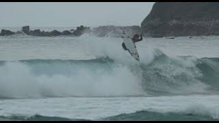
Fun Wind Swell Arriving in the Northeast this Weekend
Good afternoon everyone,
We hope all of you got a fair share of last Friday’s swell. We won’t get into details, but that was certainly some of the best Second Beach we’ve seen in a while. If you didn’t get a chance to get out there, fret not, there’s more surf on the way!
A ridge of high pressure will build south of the RI and NY waters Thursday night and Friday, and another strong cold front will move across the region late Saturday into Saturday evening. During this period of time, SW winds of 20 to 25 knots (with gusts up to 35 knots) will kick up some short period wind swell for the Northeast. Winds then swing around to the NW Sunday.

Building high pressure ridge (Carolinas region) for Friday afternoon (courtesy of NCEP/NOAA).
Saturday will see the bulk of the wind swell on offer, though SW winds will present some choppy conditions. Peak wave heights of 6 ft @ 7 seconds out of the South in Rockaway and 8 ft @ 8 seconds out of the Southwest in Rhode Island are forecasted for Saturday around noon. This translates to about waist- to stomach-high+ surf at both locations. The wind swell will get knocked down a bit Sunday morning from the wind direction change to the NW, but the NW winds will clean up whatever surf is left.

Southwest winds generating wind swell for the Northeast Saturday morning (courtesy of earth.nullschool.net).
We encourage surfers of all levels, especially beginners that are eager to clock in some hours in the lineup, to get out Saturday and Sunday morning! This weekend will provide perfect surf to hone your skills. Make sure to bring your favorite groveler and/or longboard. And as always, make sure to contact either surf shop with any inquiries about incoming swell or equipment.
Cheers,
The BW Team


